Description
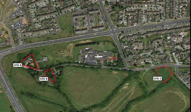
The subject lands are located approximately 1 kilometre west of Clondalkin village in Dublin 22. The sites are well connected with
the R126 linking the area to the N4 and N7 a few kilometres north and south respectively.
SITE A comprises a level greenfield site with an area of 0.6 Acres (0.24 Ha) located at a cul de sac on the Upper Nangor Road in Clondalkin, Dublin 22. Under the South Dublin County Council Development Plan 2016 – 2022 the site is zoned Objective RES N “To protect and/or improve residential amenity”.
SITE B comprises a regular shaped plot of 0.45 Acres (0.18 Ha) with a derelict detached house. The site is located opposite site A on the Upper Nangor Road. Under the South Dublin County Council Development Plan 2016 – 2022 the site is zoned Objective RES N “To provide for new residential communities in accordance with approved area plans”.
SITE C is a regular shaped plot situated adjacent to the Kilcarberry Castle development. The site has an overall curtilage of 1.17 Acres (0.47 Ha). Under the South Dublin County Council Development Plan 2016 – 2022 the site is zoned Objective RES N “To provide for new residential communities in accordance with approved area plans”.
